All Data Scanning is your solution to meet the ever-changing demands of your customers. Our advanced 3D scanning capabilities, including interactive virtual walk-throughs and cutting-edge tools, allow you to optimize your spaces at every stage of their lifecycle, keeping you ahead of the curve.
We can quickly digitize your property portfolio anywhere in Australia, without the need for you to invest in hardware or employee training. By integrating our scanning technology into your business operations, you gain a competitive advantage in the marketplace.
By leveraging the power of 3D scanning, you can gain insights into your properties that were never before possible. Our technology allows you to analyze every detail of your space, providing you with the information you need to make informed decisions about how to optimize your spaces for maximum efficiency and profitability.
To download the brochure click here
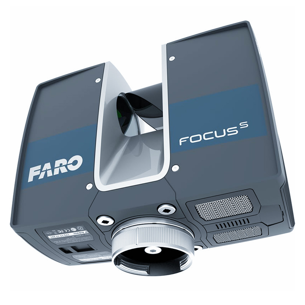
The Faro Focus S70 is ideal for clients who require precise measurements of physical components or environments for industrial or manufacturing purposes. It uses a laser scanner that can capture detailed information about an object or environment, making it ideal for industrial inspection, site investigation, and industrial reverse engineering. It offers high accuracy and smooth-operating technology to increase efficiency and cost savings. The Faro S70 can also be used to scan small details of objects for 3D printing applications.
On the other hand, the Matterport Pro3 is an advanced digital camera that is best suited for clients in the real estate, architecture, and construction industries who require fast and accurate 3D scanning of interior spaces. It uses a combination of infrared sensors and a high-resolution camera to capture images of the environment and build an immersive 3D model of the space. With the ability to scan spaces at up to 25 frames per second, it creates accurate 3D models that can be viewed at multiple scales. It can create an immersive experience for clients to virtually tour a space as if they were inside, making it a great tool for showcasing properties or designs.
3D scanning and reality capture is evolving to help facility managers visualize and navigate complex buildings and access important asset data.
Imagine a situation where a new light fitting is required in a meeting room in a Commercial Office Building in the CBD. The maintenance department might receive a message with basic details such as “faulty light” and the room number and floor. But a technician still has to locate the room, typically by consulting a floor plan or using their own personal knowledge, then walk there to identify the specific fitting and the parts and tools required for the job.
Managing a built asset is all about efficient resource planning and optimizing processes to ensure that things run smoothly, but certain tasks can be held back if property and facility management teams experience problems identifying and locating different spaces, systems or equipment.
Advanced 3D scanning and reality capture technology can eliminate these issues by providing FM teams with immediate access to dimensionally accurate, realistic 3D representations of spaces that can be easily navigated and interrogated before having to visit the actual location in person. The advantages can ultimately help drive down the cost of occupying a building.
The data can then be viewed in All Data Portal which is browser-based so anyone can click on a link to access and explore buildings as a 3D walkthrough. Or the floorplans in IndoorViewer can be navigated in 2D ‘top down’ view, on any mobile device, which when clicked on display 3D walkthroughs showing rooms, objects and assets, such as machines or pieces of equipment. These important visual cues can help technicians clearly identify, not only the location of a repair or maintenance task, but also the specific product or item that requires attention.
Its Digital Twin will allow a building user to create and send an incident report to a technician, including a photograph of the location where a failure occurred. The software then automatically locates the specific office and displays it in IndoorViewer where a virtual inspection can be carried out before proceeding to the site.
In addition, the platform provides access to all relevant documents and provides directions to the location of the alert, reducing the time spent looking for it and dependence on local and personal familiarity with spaces.
To help speed up internal navigation, All Data incorporates a routing option that enables users to find the fastest route from point A to B. A virtual path in the walkthrough shows you where you will be going to get to the location. In addition, it is possible to create and assign maintenance tickets in the 3D model that include exact location references.
Capturing vast amounts of spatial information extremely quickly, with a high level of accuracy, our 3D laser scanning service helps our clients make decisions about design, confirm as-built compliance, and monitor built and natural assets with ease.

Copyright © 2022 All Data & Communications
